About the Greenbelt Commission
The Greenbelt Commission advises the City Council on policies pertaining to the promotion, acquisition, maintenance, and improvement of the open spaces, greenways, and trailway systems in the City of Norman. Meets the 3rd Tuesday of each month; 5:30p.m., Development Center Conference Room B, 225 N. Webster Ave.
Norman Greenbelt Enhancement Statement is required for all preliminary plats and NORMAN 2025 Land Use and Transportation Plan Amendments. See link below for forms:
Frequently Asked Questions
What is the history of the Greenbelt Commission?
The idea of a Greenbelt System for Norman emerged from a planning process launched by the city in the early 1990s. The resulting Norman 2020 Land Use and Transportation Plan was completed in September 1996, and contained five goals, No. 5 being the idea for a greenbelt.
"Goal 5. Greenbelt Development. Establish a greenbelt system for Norman. Policies identified with that goal include:
- Use greenbelts to preserve environmentally sensitive lands which, generally, are also the least suitable for development.
- Use the greenbelt area to link together existing recreation areas.
- Create a multipurpose greenbelt corridor."
To assess that goal, the City Council appointed the Citizens Greenbelt Steering Committee to study the feasibility and merits of the idea. The seven-member committee reviewed a wide variety of rural and urban programs and projects across the United States and in Britain, where the greenbelt concept originated. It produced a document called "A Report on Greenbelts and Greenways for Norman, Oklahoma" (click to download a PDF version) and presented the report to the City Council in October 1997. The report's conclusion was positive.
The committee recommended that the greenbelt ideas be pursued because of their "enormous immediate and long-term benefits" in the areas of economic impact and quality of life.
In the late fall of 1999, the Steering Committee chair was asked to recommend a "Proposed Study and Scope of Work" for establishing a Greenbelt System. On February 22, 2000, the City Council created the Greenbelt Commission and appointed [35] members to draft a plan.
On July 29, 2002, the Greenbelt Commission presented its proposal, “Green Dreams,” to a joint study session of the Norman City Council and the Norman Planning Commission.
What are the goals of the Greenbelt Commission?
The Greenbelt Commission is dedicated to working with the entire community to enable the City of Norman to:
- prepare for future growth
- preserve the natural features special to Norman
- protect environmentally sensitive areas
- enhance recreational opportunities throughout the city
- encourage a system of green spaces that contribute to the beauty and quality of life in our community--for all of us and for future generations.
What is a Greenbelt?
In Norman, the term Greenbelt refers to three ways to protect natural areas and open space with a system of land parcels that work together to help maintain the beauty and liveability of our city. They are:
- Norman's existing public parks, golf courses, and nature preserves. These are already open to the public for recreation.
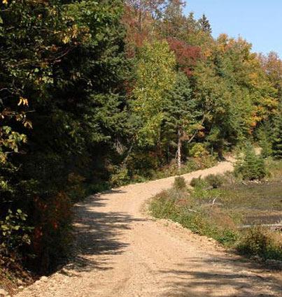
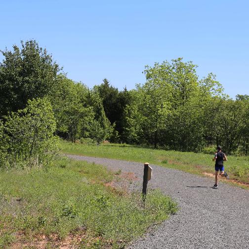
- A system of trails (both on and off-road) between parks and other open spaces, that will allow people to walk, run, bike, skate or ride horses. These would typically be publicly owned and open to the public.
- Large areas of privately owned lands which may not allow public access, but will help beautify the city. Examples of such areas are farmland dedicated to permanent agricultural use and portions of private residential developments set aside for open space.
Who serves on the Commission?
The Commission member come from all parts of town and a variety of professions, but they all share a commitment to keeping Norman a wonderful place to live.
How will land for the Greenbelt System be obtained?
No decision have been made about obtaining land for the Greenbelt System.
Possibilities include:
- City-owned land or easements
- private land with conservation easements
- purchase of development rights
- donations
- the newly formed Norman Area Land Conservancy, Inc., created to help Norman develop an open space system. (The Conservancy will serve the City in much the same way as the Friends of the Library serve the public library system.)
More Information
Glossary
- Amenity. The pleasurable or aesthetic, as distinguished from the utilitarian, features of a plan, project, or location.
- Bikeway. A thoroughfare reserved for bicycles either exclusively or during specially assigned periods.
- Cityscape. The urban equivalent of a landscape—the shape a city (or one of its parts) presents to the eye, particularly from a distance.
- Comprehensive plan. An official document adopted by a local government setting forth its general policies regarding the long-term physical development of a city or other area.
- Compulsory purchase. See eminent domain.
- Condemnation. A term used interchangeably with “eminent domain” to denote the compulsory acquisition of private property for public use with compensation to the owner. When the property is taken for public use the reasonable value of the property must be paid the owner.
- Conservation. The protection of the resources of man’s environment against depletion or waste and the safeguarding of its beauty.
- Conservation easement: A right which one person has relative to the land of another for the specific purpose of protection of property against loss, misuses, or waste, particularly in the modern sense of the term, natural resources, wildlife, and natural settings in mountains, rivers, lakes, prairies, etc. not inconsistent with general property rights of the owner.
- Covenant. An agreement between two or more persons, often written into a deed, to do or refrain from doing certain acts.
- Deed. A written instrument under seal by which an estate in real property is conveyed by the grantor to a grantee. The deed may be a full covenant and warranty deed, a bargain and sale deed, or a quit-claim deed.
- Development rights. The rights to develop land, as distinguished from ownership of it. Similar but broader than conservation easement, because development rights may be purchased with the aim of developing instead of conserving private land.
- Easement. An acquired right of use, interest, or privilege in lands owned by another. Easements are more permanent and often more restrictive than municipal land use regulation, which can shift with the political winds.
- Eminent domain. The right of a government to acquire private property for public use or benefit upon payment of just compensation. The term “condemnation” is often used interchangeably with eminent domain but may also apply to the demolition by public authority of a dangerous structure where no compensation is paid and the condemned property is not acquired by the government.
- Environment. The sum of all external conditions influencing the growth and development of an organism.
- Excess condemnation. The taking by eminent domain of more property than is necessary for a public improvement.
- Fee. Ownership of the title to real property. Fee simple is the largest possible estate in land, of indefinite duration and inheritable without limitation. This is commonly meant when the word “ownership” is used. Equivalent to “freehold.”
- Frontage. The front part of a building or parcel of land.
- Greenbelt. A wide band of countryside surrounding or intertwined within a city on which building is generally barred, usually large enough to form an adequate protection against objectionable uses of property or the intrusion of nearby development. The concept is of British origin, but in the United States loosely describes almost any kind of green space.
- Greenways. A linear open space established along a corridor, such as a river or railroad right-of way, and usually developed for non-vehicular public use. Examples include the Platte River Greenway in Denver, the Capital Area Greenway in Raleigh, North Carolina, and the Willamette Greenway in Portland, Oregon.
- Land development. The improvement of land with utilities and services, making the land more suitable for resale as developable plots for housing or other purposes.
- Land trust. Predominantly nonprofit local, regional, or statewide organizations that work with private landowners to protect their land for conservation, recreation, and other public benefit. Typically, land trusts acquire land, conservation easements, management agreements, or other interests in real property for the establishment of such public purposes as urban parks, gardens, greenways, wildlife corridors, open space, wetlands, groundwater-recharge areas, wildlife habitat, and river corridors or for the preservation of historic lands or existing land-uses, such as agriculture. Each land trust has its own mission statement, specific to its setting and region. In 1998, the United States had more than 1,200 land trusts, distributed over all but three states (Oklahoma, Arkansas, and South Dakota). The trusts owned more than 800,000 acres and owned conservation easements on almost 1.4 million acres. They had transferred almost a million acres to third parties and had protected 1.8 million acres of land by other methods.
- Land-use plan. The official formulation of the desired future uses of land, including the public and private improvements to be made on it and the assumptions and reasons for arriving at the determinations.
- Market value. A hypothetical figure, used in appraisal, condemnation proceedings, and assessments for taxes, which a willing buyer presumably would pay to a willing seller in a free market.
- Open space. That portion of the landscape which has not been built over and which is sought to be reserved in its natural state or for agricultural or outdoor recreational use.
- Option. The exclusive right, for an agreed period, to purchase or lease a property at a stipulated price or rent.
- Plat. A map or chart of a city, town, section, or subdivision, indicating the location and boundaries of individual properties.
- Police power. The state’s inherent right to regulate an individual’s conduct or property to protect the health, safety, welfare, and morals of the community. Unlike the exercise of eminent domain, no compensation need be paid.
- Property tax. A levy on the owners of real property. It is the main source of revenue for local governments in some parts of the United States. In Oklahoma, property taxes fund primarily schools and county governments
- Right-of-way. The right of one person, of several persons, or of the community at large, to pass over, under or through the land of another and/or the right to place public utilities, roads, sidewalks, storm drainage or other public improvements on the land.
- Riparian rights. The rights accruing to a landowner on the bank of a natural watercourse.
- Scenic easement. the grant by a landowner of the right to use his or her land for scenic enhancement. Septic tank. A tank plus a leaching pit or trenches in which waste matter is filtered and decomposed through bacterial action. Distinguished from cesspool, a buried, perforated tank that retains most of the waste solids.
- Sewage treatment. The artificial removal of pollutants from sewage, their transformation into an inert state, and the altering of the objectionable constituents by controlled physical, chemical, or biological processes.
- Speculation. The practice of buying and selling land or other property in order to profit by the rise or fall in their market value; implies a riskier venture than investment.
- Subdivision. The process of dividing a given area of land into plats, sites, blocks, or lots with streets or roads and open spaces.
- Title. The legal right to property ownership.
- Zoning. The demarcation of a city by ordinance into zones and the establishment of regulations to govern the use of the land within each zone. Aesthetic zoning is the regulation of property by zoning in the interest of beauty.
- SOURCES: adapted from Charles Abrams, The Language of Cities: A Glossary of Terms (Viking, 1971). Updated from Julie Ann Gustanski and Roderick H. Squires, eds. Protecting the Land (Island Press, 2000) and Loring LaB. Schwarz, ed., Greenways (Island Press, 1993).
Links
- Adopted 2012 Greenways Master Plan
- Norman Greenbelt Enhancement Statement
- Reference Appendices to the 2012 Greenways Master Plan